|
| *****SWAAG_ID***** | 872 |
| Date Entered | 07/04/2015 |
| Updated on | 08/04/2015 |
| Recorded by | Tim Laurie |
| Category | Settlement |
| Record Type | Archaeology |
| Site Access | Public Access Land |
| Record Date | 27/03/2015 |
| Location | West Bolton Parks |
| Civil Parish | Castle Bolton with E and W Bol |
| Brit. National Grid | SE 00806 92112 |
| Altitude | 328m |
| Geology | Glacial drift over limestone. |
| Record Name | West Bolton Parks. Ring cairn or reduced round cairn located 100m NNE of the Beldon Beck Ring Cairn |
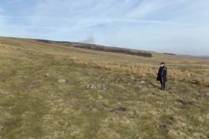
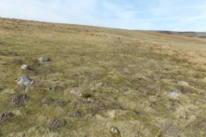
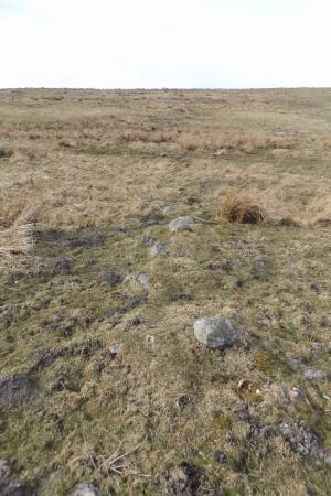
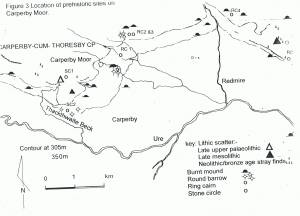
| Record Description | This small ring bank marked by a ring of boulders some 9m diameter overall is located some 100m NNE of the Beldon Beck Ring Cairn, RC01 on Figure 3 below and Laurie 2003, Figure 61. This ring bank is located at the base of a hill slope and could conceivably be a small ring cairn but is not appropriately located and is more likely to be a substantial round cairn reduced by stone quarrying for an adjacent field bank, part of an extensive field system associated with later settlements nearby, to be recorded separately. The Beldon Beck Ring Cairn located at a viewpoint on the eastern bank of Beldon Beck, has been differently interpreted as a Ring Cairn of earlier Bronze Age character.(see previous SWAAG Record No 871). Despite my remarks above, both of these ring banks could prove to be ring cairns. |
| Dimensions | 9m diameter overall approximately |
| Additional Notes | See SWAAG Record 871 for details of the nearby Beldon Beck Ring Cairn. |
| Image 1 ID | 6188 Click image to enlarge |
| Image 1 Description | Small ring bank located close to the Beldon Beck Ring Bank, RC01 on Figure 3, Laurie 2003. |  |
| Image 2 ID | 6189 Click image to enlarge |
| Image 2 Description | Small ring bank located close to the Beldon Beck Ring Bank. |  |
| Image 3 ID | 6190 Click image to enlarge |
| Image 3 Description | Coaxial field bank passes close to the ring bank which may have been reduced by stone robbing for this later boundary. |  |
| Image 4 ID | 6191 Click image to enlarge |
| Image 4 Description | Carperby Moor and West Bolton Parks. Location Map. This second ring bank is located 100m NNE of the Beldon Beck Ring Cairn, RC1 on this Map (Laurie 2003, Figure 61). |  |


